
Okaukuejo
Etosha National Park
Okaukuejo is famous for its flood-lit waterhole giving visitors the opportunity to observe some of Etoshas wildlife interacting at close quarters during both night and day
Visitors to Namibia arriving at the Hosea Kutako International Airport an easily gain access to the B1 highway, which leads to Etosha National Park. This highway is the main road connecting Windhoek to other cities and tourist destinations in Namibia.
Directions:
Start: Hosea Kutako International Airport
Continue to B6
3 min (1.3 km)
Head northeast
56 m
Turn right
190 m
At the roundabout, take the 2nd exit
1.1 km
Follow B6 and B1 to Lang Street in Otjiwarongo
2 hr 57 min (290 km)
Turn right onto B6
40.5 km
Turn right onto Nelson Mandela Ave
3.2 km
Turn right onto Robert Mugabe Ave
1.7 km
At the roundabout, take the 2nd exit
180 m
Continue straight
110 m
Continue onto B1
800 m
Turn right onto the ramp to B1
110 m
Keep right to continue toward B1
260 m
Continue onto B1
69.3 km
Turn right to stay on B1
174 km
Follow C38 to your destination in Okaukuejo
1 hr 59 min (186 km)
At the roundabout, take the 1st exit onto Lang Street
2.4 km
Turn left onto B1/C38
Continue to follow C38
183 km
Turn left
500 m
Turn right
Destination will be on the left
47 m
Arrive: Okaukuejo Resort
Visitors can also use GPS or a mapping app to navigate from the airport
to the B1 highway.
The GPS coordinates for the Hosea Kutako International Airport are:
-22.4877, 17.4629
It is important to note that while traveling on the B1 highway, visitors
should obey the speed limit, as there are frequent police checkpoints
along the road. Visitors should also be prepared for varying road conditions,
as the B1 highway can be quite rural in some areas and may not be well-maintained
in others.

If you're driving along the B1 highway in Namibia, there are several
noteworthy places you can visit. Below is information about two of these
towns:
Otjiwarongo
GPS Coordinates: -20.4511, 16.6636
Brief history: Established as a German colonial settlement in the early
1900s, Otjiwarongo is a town along the B1 highway. It's famous for its
hot springs and the Cheetah Conservation Fund.
Fun fact: Known as the "Oasis of the North," Otjiwarongo is
home to several hot springs with therapeutic properties.
Outjo
GPS Coordinates: -20.1129, 16.1613
Brief history: Outjo is a town located near the King Nehale Gate to Etosha
National Park. It was established as a German colonial settlement in the
late 1800s and is well-known for its hot springs and wildlife parks.
Fun fact: Outjo is located in the heart of Namibia's wildlife conservation
area, giving visitors the chance to see a variety of African wildlife,
including cheetahs, leopards, and elephants.
Along the B1 highway, there are also essential services such as fuel stations,
police stations, hospitals, and convenience stores.
Gates to Etosha National Park:
Anderson Gate -19.3314, 15.9397
King Nehale Gate -18.4979, 16.7431
Von Lindequist Gate (Namutoni Gate) -18.7999, 17.03298
Travel time and distance to the gates are as follows:
Anderson Gate: Travel time of approximately 4 hours 38 min, distance of
approximately 458km /285 miles.
King Nehale Gate: Travel time of approximately 6 hours 33 min, distance
of approximately 650 km / 404 miles
Von Lindequist Gate (Namutoni): Travel time of approximately 5 hours 46
min, distance of approximately 573 km / 356 miles
The Anderson Gate is the most recommended gate to reach the Etosha Okaukuejo
Camp and is located on the western side of the park.
To get from Anderson Gate (19.5114° S, 16.4317° E) to Okaukuejo
Camp (19.1447° S, 15.8094° E ) , you will need to drive approximately
20 minutes. The exact directions will depend on your starting location
and mode of transportation, but the quickest route is likely to be via
the B1 highway and other major roads in the area.
Please note that driving conditions in Etosha National Park can be challenging
and it is advisable to take precautions such as bringing plenty of water,
food, and spare tire, as well as making sure your vehicle is in good condition.
It is recommended to use a GPS navigation device or map to help you find
your way, as some of the roads in the park can be difficult to navigate.

Okaukuejo is famous for its flood-lit waterhole giving visitors the opportunity to observe some of Etoshas wildlife interacting at close quarters during both night and day
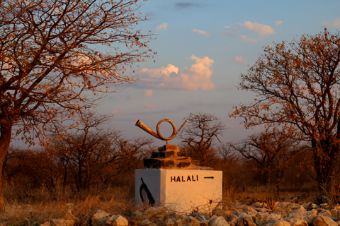
Halali is situated halfway between Okaukuejo and Namutoni. Surrounded by some of the most popular waterholes in the park Halali is set amongst shady mopane trees.

Namutoni is located on the eastern side of Etosha National Park and is centred around a beautiful old German Fort overlooking the King Nehale waterhole which is flood-lit at night

Nestled in the dolomite outcrops of the western Etosha National Park, Dolomite Camp offers an intimate experience in one of the most scenic areas Etosha
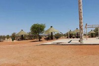
Olifantsrus offers camping accommodation in the less-utilized western section of Etosha. Species such as black rhino are well-established in this quieter part of the park.
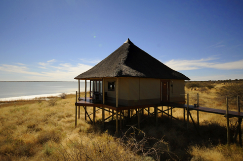
Onkoshi is a low impact environmentally friendly, exclusive lodge on the eastern edge of the Etosha on elevated wooden decks overlooking the pan
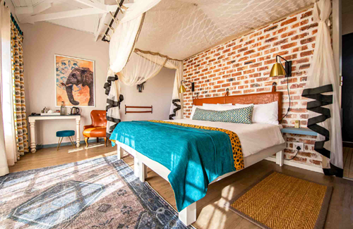
Join us at this stylish lodge. It's the place to open doors to the mystery and magic of Etosha...
Read More
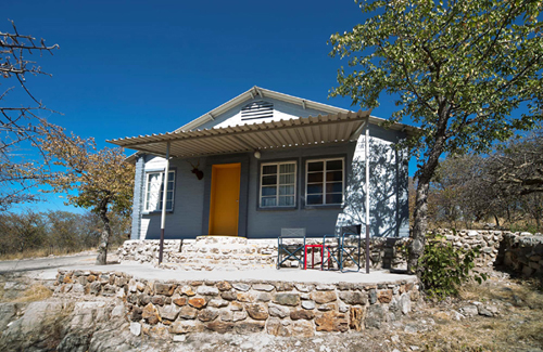
Down to earth, relaxed, innovative and charming...
Read More
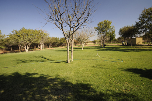
An inviting green lawn surrounded by mopane savannah is 'home sweet home' ...
Read More
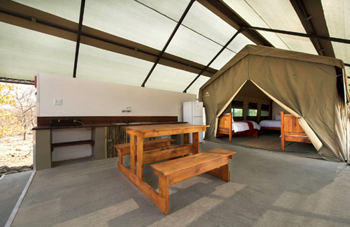
Do you like camping, but shy away from the strenuous packing of camping equipment...
Read More
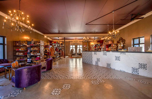
Strikingly set on the Andoni plains, one kilometre from...
Read More

Affordable accommodation at the entrance to Namibia's animal kingdom...
Read More
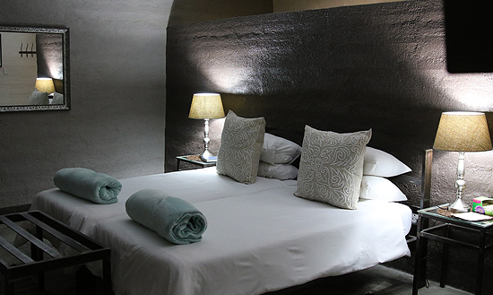
A private atmosphere and offers reasonably priced accommodation...
Read More
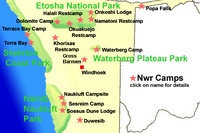
Plan your trip to Namibia here!